Copyright and other blogs currently being worked

ALCHEMY OF CLAY: Art and life connect! This fabric design is by Amanda Richardson - British fabric & textile artist in Penberth Valley, Land's End, Cornwall, England, UK

My info

Showing posts with label trails. Show all posts

Monday, April 10, 2017

Mt. Mitchell arrival

It's getting there that's a challenge!


Just 40 miles from where I get on the Blue Ridge Parkway...and most of the driving is very pleasant, though I seldom got up to the 45 mph speed limit. On a Sunday that meant many drivers were on the road because it was wonderful weather.  But it's nothing in the early spring compared to the leaf peepers (tourists) in the fall!

Turning from the Parkway into the NC State Park, the road is steep and has some sharp corners for 4 miles to the top parking lot. (Can you see the cellular towers at the top of that mountain right of center? That's not Mt. Mitchell!)

Nothing opens until May 1 up here, either visitors centers, stores, restaurants, camping, museums or restrooms!

So this sign says the summit is 285 yards up a ramp.  Oh my, what a climb for this old one!


There are some frequent benches, because they obviously know many tourists are out of shape and need to stop and breathe.  I was a bit upset sad at one woman who stopped to smoke a cigarette.  And she was also having trouble breathing as she climbed the ramp!


The Mountains to the Sea Trail crosses the Mt. Mitchell trail/ramp early on. It used to be the Mt. Mitchell Trail.
And Balsam Nature Trail also leads off of this main ramp.  Off into the woods! Maybe I'll try this later...

 The greenery up here is from Hemlocks.

Looking up towards the lookout. I don't know how steep the incline of that 285 yards is...but it is also very high elevation so the air is thinner.

Sunday April 2 was a great day for looking out at vistas.

I keep on going with my turtle attitude...and as I slowly pant and take small steps, I mentally chant "Beauty" but by the time I get to the top, I notice I'm just concentrating on breathing.


This modernized lookout has great photo-dioramas going in each direction, complete with the correct names for the mountains you see. It is much better than it was 10 years ago when I moved to NC.

That's Elisha Mitchell's grave at the foreground.

Looking from the observation deck, I chose west as my first direction to look closely at the photographic depiction of what I was seeing, and then to match a mountain to a name.  It's so much easier with no glare from a cover over a real photo, or the bronze engravings that were really difficult to read.


It's not that exciting unless you've been to some of the areas around the mountains.  To the left are Big Butt and Little Butt, which caused the young people to snicker (and lots of young at heart also.)

On the right across all this wilderness are Big Bald and Little Bald, but in the valley in front of them is Burnsville, which I've visited several times.  You can't really see the town since it's so far away.
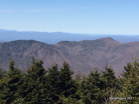
I'm not sure if this ridge had any name, but it was looking out over the picture.

I'm pretty sure that center in the distance is I-40 headed west. But it wasn't on the photo, so it could be another road.

Today's quote:


It is important to make decisions from a place of balance in your life by taking a breath and checking in with heart and mind. Madisyn Taylor

Monday, May 25, 2015

Trail choices


There are a lot of trails in Montreat.  Highway 9 north from Black Mountain leads into this little village, and then you have to go back out the same way...because it's the deadend!

Right after arriving at the stone gateway to the town, a parking lot on the right is the site of this map, and once you cross the little bridge over Flat Creek, you've got several choices of trails.


Elizabeth Trail runs above the creek to the left, up into the area of the village.

It's a relatively easy trail, which includes looking down on the town's homes

And here is where trail signage loses me...the arrow yes, but what's that above it?

A serious hiker went in this direction...and later I went down this road to see what it led to...

There were all kind of heavy equipment, chippers...

snow plow attachments...

 And trail signs by the big dump truck.

What do the 2 hiker silhouettes mean anyway?

Sorry the signs are out of focus...something about wintertime in the protected sleeve.


And there behind the truck is the trail to Rainbow Mountain.  At least I think that's what the tiny symbol meant.


There's an actual ford across the creek, which is how the trucking equipment gets over to the Highway 9, or Montreat Rd.

Why haven't I shared pictures of the trails myself? Well, my hiking days are over due to breathing limitations. I can travel from car for short distances on level terrain these days.